Lakenheath72 (talk | contribs) No edit summary Tag: sourceedit |
(→Background information: grammar) Tag: sourceedit |
||
| (10 intermediate revisions by 2 users not shown) | |||
| Line 1: | Line 1: | ||
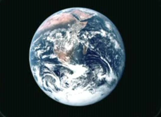
| + | [[File:Earth, The Blue Marble.jpg|thumb|Western Asia on planet Earth]] |
||
| − | '''Asia''', also referred to as the '''Orient''', was the largest continent on [[Earth]]; it made up a majority of the [[Eurasia]]n landmass. |
||
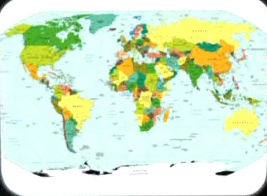
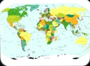
| + | [[File:Earth political map.jpg|thumb|Asia on a 21st century-era political map of Earth.]] |
||
| + | '''Asia''' was the largest [[continent]] on [[Earth]]; it made up a majority of the [[Eurasia]]n landmass. Western Asia was where some of the [[Middle East]]ern countries were located. A person who was from this continent was sometimes referred to as an Oriental. The [[equator]], a line of latitude that divided the Earth into northern and southern hemispheres, passed through this continent. |
||
| + | In the late [[17th century]], a cartographer created a map, from what was learned from [[European]] explorers and traders, of the lands that had coastlines on the [[Bay of Bengal]], the [[Indian Ocean]], and the [[Arabian Sea]]. The map included portions of the western, southern, and south-eastern Asian continent. (''[[Star Trek: Enterprise]]'', ''opening credits'') |
||
| ⚫ | |||
| ⚫ | |||
| ⚫ | |||
In the same century, the Asian continent was a location of many [[Brush Wars]] fought by the two main opponents in the [[Earth Cold War|Cold War]], the USSR and the [[USA]], where these two supplied different groups with [[weapon]]s to gain influence in Asia, but to prevent a full-scale [[conflicts|war]]. This situation was similar to the involvement of the [[Federation]] and the [[Klingon Empire]] on the [[planet]] [[Neural]] in the mid-[[23rd century]] as was remarked by [[Captain]] [[James T. Kirk|Kirk]]. ({{TOS|A Private Little War}}) |
In the same century, the Asian continent was a location of many [[Brush Wars]] fought by the two main opponents in the [[Earth Cold War|Cold War]], the USSR and the [[USA]], where these two supplied different groups with [[weapon]]s to gain influence in Asia, but to prevent a full-scale [[conflicts|war]]. This situation was similar to the involvement of the [[Federation]] and the [[Klingon Empire]] on the [[planet]] [[Neural]] in the mid-[[23rd century]] as was remarked by [[Captain]] [[James T. Kirk|Kirk]]. ({{TOS|A Private Little War}}) |
||
In [[1968]], a government ''[[coup]]'' took place in Asia which was considered by [[Spock]] to have been "dangerous" for Earth's political development. ({{TOS|Assignment: Earth}}) |
In [[1968]], a government ''[[coup]]'' took place in Asia which was considered by [[Spock]] to have been "dangerous" for Earth's political development. ({{TOS|Assignment: Earth}}) |
||
| ⚫ | |||
| − | In [[ |
+ | In the late 20th century, Asia was seen on the [[photograph]] "[[The Blue Marble]]". ({{TOS-R|The Cage}}) |
| + | |||
| + | From [[1992]] to [[1996]], [[Khan Noonien Singh]] was absolute ruler of more than a quarter of Earth's land mass, from Asia to the Middle East. ({{TOS|Space Seed}}) |
||
In [[2153]], the first [[prototype]] of the [[Xindi superweapon]] self-destructed over Earth; portions of this [[probe]] were recovered by a [[Vulcan]] ship in Central Asia, due to an undetonated charge in the vessel's engine. ({{ENT|The Expanse}}) |
In [[2153]], the first [[prototype]] of the [[Xindi superweapon]] self-destructed over Earth; portions of this [[probe]] were recovered by a [[Vulcan]] ship in Central Asia, due to an undetonated charge in the vessel's engine. ({{ENT|The Expanse}}) |
||
| + | A [[21st century]]-era political map of Earth was stored in the {{USS|Enterprise|NCC-1701}}'s [[USS Enterprise (NCC-1701) library computer|library computer]] in [[2254]]. The Asian continent was seen on this map. This map was among the materials viewed by the [[Talosian]]s when they scanned the ''Enterprise'' computer. ({{TOS-R|The Cage}}) |
||
| − | When [[Worf]] was a child, he went [[camping]] in Asia with his foster father [[Sergey Rozhenko]] in the [[Ural Mountains]], which lie approximately 2,000 [[kilometer]]s east of [[Minsk]]. ({{DS9|Change of Heart}}) |
||
| ⚫ | |||
| − | {{bginfo|The {{USS|Mekong}} was named after a river in Southeast Asia.}} |
||
== Background information == |
== Background information == |
||
| ⚫ | |||
| − | The maps used in the original {{e|The Cage}} were published in the early [[1960s]]. The landmass of Asia was seen on two political maps of the northern hemisphere. Decades later, the map used in the remastered "The Cage" was a [[Central Intelligence Agency]] map published either in [[April]] [[2007]] ''[http://www.lib.utexas.edu/maps/world_maps/world_pol_2007.pdf]'' or [[September]] [[2008]] ''[http://www.lib.utexas.edu/maps/world_maps/world_pol_2008.pdf]''. The difference, which was not noticeable at the resolution of the image from the episode, was the addition of Kosovo, which gained its independence between the releases. From 2007 on, there was a remark about claimant rights to [[Antarctica]]; the next release was in [[January]] [[2011]] (two years after the "The Cage" remastered was broadcast). [http://www.lib.utexas.edu/maps/world_maps/world_pol_2011.pdf] The United Nations had divided Asia into five sub-regions. [http://en.wikipedia.org/wiki/United_Nations_geoscheme_for_Asia] Capitals and major cities were from the CIA maps. |
||
| + | The 17th century map, known as "Harmonia macrocosmica seu atlas universalis et novus, totius universi creati cosmographiam generalem, et novam exhibens", was created by {{w|Andreas Cellarius}}. A scan of the original can be found [http://commons.wikimedia.org/wiki/File:Cellarius_Harmonia_Macrocosmica_-_Situs_Terrae_Circulis_coelestibus_Circundatae.jpg here] |
||
| + | |||
| ⚫ | [[Retroactive continuity]]: Several [[20th century]]-era maps depicting Asia, or portions of it, were stored in the {{USS|Enterprise|NCC-1701}} [[library computer]] in [[2254]]. These maps included a continent projections map, an eastern hemisphere map, two political maps of the northern hemisphere, and a statistical map. These maps were among the materials viewed by the [[Talosian]]s when they scanned the ''Enterprise'' computer. ({{TOS|The Cage}}) |
||
| + | |||
| + | Decades later, a Central Intelligence Agency map was used for the remastered "The Cage". This map was published either in April 2007[http://www.lib.utexas.edu/maps/world_maps/world_pol_2007.pdf] or September 2008.[http://www.lib.utexas.edu/maps/world_maps/world_pol_2008.pdf] The difference, which was not noticeable at the resolution of the image from the episode, was the addition of Kosovo, which gained its independence between the releases. |
||
<gallery> |
<gallery> |
||
| − | File:Earth |
+ | File:Earth continents.jpg|Asia on a map of Earth's continents. |
| − | File: |
+ | File:Eastern hemisphere graphic, The Cage.jpg|Asia on a map of Earth's eastern hemisphere. |
| − | File:Earth |
+ | File:Earth map, 20th century, North Pacific.jpg|Asia on a 20th century-era political map of Earth's North Pacific Ocean region. |
| + | File:Earth map, 20th century, Northern Hemisphere.jpg|Asia on a 20th century-era political map of Earth's northern hemisphere. |
||
| + | File:Statistical map.jpg|Asia on a statistical map. |
||
</gallery> |
</gallery> |
||
| − | LIST OF COUNTRIES ON MAP |
||
{| class="grey" width=100% |
{| class="grey" width=100% |
||
| + | |- |
||
| + | ! colspan="3" style="text-align:center" | Features from the CIA map |
||
|- |
|- |
||
! style="width:5%" | Country |
! style="width:5%" | Country |
||
| Line 58: | Line 69: | ||
|Thimpu |
|Thimpu |
||
|A southern Asian country. |
|A southern Asian country. |
||
| + | |- |
||
| + | |British Indian Ocean Territory |
||
| + | | |
||
| + | |An Indian Ocean archipelago administered by the United Kingdom. Diego Garcia was an island in this territory. |
||
|- |
|- |
||
|Brunei |
|Brunei |
||
| Line 73: | Line 88: | ||
|China |
|China |
||
|Beijing |
|Beijing |
||
| − | |A country in eastern Asia. Major cities - Baotou, Changchun, Changsha, Changqing, Chengdu, Dalian, Datang, Fuzhou, Guangzhou, Guiyang, Hangchou, Harbin, Hefei |
+ | |A country in eastern Asia. Major cities - Baotou, Changchun, Changsha, Changqing, Chengdu, Dalian, Datang, Fuzhou, Guangzhou, Guiyang, Hangchou, Harbin, Hefei, Jilin, Jinan, Kashi, Kunming, Lanzhou, Lhasa, Nanchang, Nanjing, Nanning, Nantang, Ningbo, Qingdao, Shanghai, Shantou, Shenyang, Shijiazhuang, Taiyuan, Tianjin, Ürümqi, Wuhan, Yantai, Xiamen, Xi'an, Zhanliang, Zhengzhou, Zibo. |
| + | |- |
||
| + | |Christmas Island |
||
| + | | |
||
| + | |An Indian Ocean territory of Australia. |
||
| + | |- |
||
| + | |Cocos (Keeling) Islands |
||
| + | | |
||
| + | |An Indian Ocean territory of Australia. |
||
|- |
|- |
||
|Cyprus |
|Cyprus |
||
| Line 82: | Line 105: | ||
|Tbilisi |
|Tbilisi |
||
|A western Asian country. |
|A western Asian country. |
||
| + | |- |
||
| + | |Hong Kong |
||
| + | | |
||
| + | |Special Administrative Region (S.A.R.) in China. |
||
|- |
|- |
||
|India |
|India |
||
| Line 130: | Line 157: | ||
|Beirut |
|Beirut |
||
|A western Asian country. |
|A western Asian country. |
||
| + | |- |
||
| + | |Macao |
||
| + | | |
||
| + | |Special Administrative Region (S.A.R.) in China |
||
|- |
|- |
||
|Malaysia |
|Malaysia |
||
| Line 228: | Line 259: | ||
|} |
|} |
||
| − | |||
| ⚫ | |||
==External link== |
==External link== |
||
* {{wikipedia}} |
* {{wikipedia}} |
||
| − | |||
[[de:Asien]] |
[[de:Asien]] |
||
Revision as of 22:51, 16 January 2016

Western Asia on planet Earth
Asia on a 21st century-era political map of Earth.
Asia was the largest continent on Earth; it made up a majority of the Eurasian landmass. Western Asia was where some of the Middle Eastern countries were located. A person who was from this continent was sometimes referred to as an Oriental. The equator, a line of latitude that divided the Earth into northern and southern hemispheres, passed through this continent.
In the late 17th century, a cartographer created a map, from what was learned from European explorers and traders, of the lands that had coastlines on the Bay of Bengal, the Indian Ocean, and the Arabian Sea. The map included portions of the western, southern, and south-eastern Asian continent. (Star Trek: Enterprise, opening credits)
During the 19th and 20th centuries, the Orient Express was a train route that traveled from Paris, in Western Europe, to Istanbul, located in Western Asia. (TNG: "Emergence")
In the same century, the Asian continent was a location of many Brush Wars fought by the two main opponents in the Cold War, the USSR and the USA, where these two supplied different groups with weapons to gain influence in Asia, but to prevent a full-scale war. This situation was similar to the involvement of the Federation and the Klingon Empire on the planet Neural in the mid-23rd century as was remarked by Captain Kirk. (TOS: "A Private Little War")
In 1968, a government coup took place in Asia which was considered by Spock to have been "dangerous" for Earth's political development. (TOS: "Assignment: Earth")
In the late 20th century, Asia was seen on the photograph "The Blue Marble". (TOS-R: "The Cage")
From 1992 to 1996, Khan Noonien Singh was absolute ruler of more than a quarter of Earth's land mass, from Asia to the Middle East. (TOS: "Space Seed")
In 2153, the first prototype of the Xindi superweapon self-destructed over Earth; portions of this probe were recovered by a Vulcan ship in Central Asia, due to an undetonated charge in the vessel's engine. (ENT: "The Expanse")
A 21st century-era political map of Earth was stored in the USS Enterprise's library computer in 2254. The Asian continent was seen on this map. This map was among the materials viewed by the Talosians when they scanned the Enterprise computer. (TOS-R: "The Cage")
| Continents of Earth |
|---|
| Africa • Antarctica • Asia • Australia • Europe • North America • South America |
Background information
In the real 1968 a coup took place in the Western Asian country of Iraq.
The 17th century map, known as "Harmonia macrocosmica seu atlas universalis et novus, totius universi creati cosmographiam generalem, et novam exhibens", was created by Andreas Cellarius. A scan of the original can be found here
Retroactive continuity: Several 20th century-era maps depicting Asia, or portions of it, were stored in the USS Enterprise library computer in 2254. These maps included a continent projections map, an eastern hemisphere map, two political maps of the northern hemisphere, and a statistical map. These maps were among the materials viewed by the Talosians when they scanned the Enterprise computer. (TOS: "The Cage")
Decades later, a Central Intelligence Agency map was used for the remastered "The Cage". This map was published either in April 2007[1] or September 2008.[2] The difference, which was not noticeable at the resolution of the image from the episode, was the addition of Kosovo, which gained its independence between the releases.
")
")
")
")
")
| Features from the CIA map | ||
|---|---|---|
| Country | Capital | Notes |
| Afghanistan | Kabul | A southern Asian country. Major cities - Herat, Kandahar. |
| Armenia | Yerevan | A western Asian country. |
| Azerbaijan | Baku | A western Asian country. |
| Bahrain | Manama | A western Asian country. |
| Bangladesh | Dhaka | A southern Asian country. |
| Bhutan | Thimpu | A southern Asian country. |
| British Indian Ocean Territory | An Indian Ocean archipelago administered by the United Kingdom. Diego Garcia was an island in this territory. | |
| Brunei | Bandar Seri Begawan | A south-eastern Asian country. |
| Burma | Nay Pyi Taw | A south-eastern Asian country. Major city - Mandalay. |
| Cambodia | Phnom Penh | A south-eastern Asian country. |
| China | Beijing | A country in eastern Asia. Major cities - Baotou, Changchun, Changsha, Changqing, Chengdu, Dalian, Datang, Fuzhou, Guangzhou, Guiyang, Hangchou, Harbin, Hefei, Jilin, Jinan, Kashi, Kunming, Lanzhou, Lhasa, Nanchang, Nanjing, Nanning, Nantang, Ningbo, Qingdao, Shanghai, Shantou, Shenyang, Shijiazhuang, Taiyuan, Tianjin, Ürümqi, Wuhan, Yantai, Xiamen, Xi'an, Zhanliang, Zhengzhou, Zibo. |
| Christmas Island | An Indian Ocean territory of Australia. | |
| Cocos (Keeling) Islands | An Indian Ocean territory of Australia. | |
| Cyprus | Nicosia | A western Asian country. |
| Georgia | Tbilisi | A western Asian country. |
| Hong Kong | Special Administrative Region (S.A.R.) in China. | |
| India | New Delhi | A southern Asian country. Major cities - Agra, Ahmadabad, Bengaluru, Bhopal, Calicut, Chennai, Cochin, Coimbatore, Hyderabad Indore, Jaipur, Jamshedpur, Kanpur, Kolkata, Lucknow, Ludhiana, Madurai, Mumbai, Nagpur, Patna, Pune, Surat, Vijayawada, Vishakhapatnam. |
| Indonesia | Jakarta | A south-eastern Asian country. Major cities - Banjarmasin, Bandung, Denpasar, Jayapura, Kupang, Makassar, Malang, Medan, Padang, Palembang, Pekanbaru, Pontianak, Samarinda, Semarang, Surabaya, Tanjungkarang-Telukbetung |
| Iran | Tehran | A southern Asian country. Major cities - Ahvaz, Esfahan, Kermanshah, Mashhad, Qom, Shiraz, Tabriz, Zāhedān. |
| Iraq | Baghdad | A western Asian country. Major cities - Al Başrah, Arbil, Mosul. |
| Israel | Tel Aviv-Yafo | A western Asian country. Major city - Jerusalem. |
| Japan | Tokyo | A eastern Asian country. Major city - Fukuoka, Hiroshima, Nagoya, Osaka, Sapporo, Yokohama. |
| Jordan | Amman | A western Asian country. |
| Kazakhstan | Astana | A central Asian country. Major cities - Almaty, Aqtaü (Aktau), Atyraü, Qaraghandy (Karaganda), Shymkent. |
| Kuwait | Kuwait | A western Asian country. |
| Kyrgyzstan | Bishkek | A central Asian country. |
| Laos | Vientiane | A south-eastern Asian country. |
| Lebanon | Beirut | A western Asian country. |
| Macao | Special Administrative Region (S.A.R.) in China | |
| Malaysia | Kuala Lumpur | A south-eastern Asian country. |
| Maldives | Male | A southern Asian country. |
| Mongolia | Ulaanbaatar | An eastern Asian country. |
| Nepal | Kathmandu | A southern Asian country. |
| North Korea | Pyongyang | A eastern Asian country. |
| Oman | Muscat | A western Asian country. |
| Pakistan | Islamabad | A southern Asian country. Major cities - Faisalabad, Hyderabad, Karachi, Lahore, Multan, Peshawar, Quetta. |
| Philippines | Manila | An eastern Asian country. Major cities - Cebu, Davao, Zamboanga. |
| Qatar | Doha | A western Asian country. |
| Saudi Arabia | Riyadh | A western Asian country. Major cities - Mecca, Medina, Jiddah. |
| Singapore | Singapore | A south-eastern Asian country. |
| South Korea | Seoul | An eastern Asian country. Major city - Pusan. |
| Sri Lanka | Colombo | A southern Asian country. |
| Syria | Damascus | A western Asian country. Major city - Aleppo. |
| Taiwan | Taipei | An eastern Asian country. Major city - Kao-hsiung. |
| Tajikistan | Dushanbe | A central Asian country. |
| Thailand | Bangkok | A south-eastern Asian country. Major city - Chiang Mai. |
| Timor-Leste | Dili | A south-eastern Asian country. |
| Turkey | Ankara | A western Asian country. Major cities - Adana, Bursa, Gaziantep, Istanbul, Izmir, Konya. |
| Turkmenistan | Ashgabat | A central Asian country. |
| United Arab Emirates | Abu Dhabi | A western Asian country. |
| Uzbekistan | Tashkent | A central Asian country. |
| Vietnam | Hanoi | A south-eastern Asian country. Major cities - Da Nang, Haiphong, Ho Chi Minh City. |
| Yemen | Sanaa | A western Asian country. Major city - Aden. |