Lakenheath72 (talk | contribs) No edit summary Tag: sourceedit |
Renegade54 (talk | contribs) m (copyedit) Tag: sourceedit |
||
| (11 intermediate revisions by 3 users not shown) | |||
| Line 1: | Line 1: | ||
| − | {{at| |
+ | {{at|xx}} |
| ⚫ | '''Africa''' was a [[continent]] on [[Earth]]. It had coastlines on the North and South [[Atlantic Ocean]]s, the [[Mediterranean]], and the [[Indian Ocean]]. The [[equator]], a line of latitude which divided the Earth into northern and southern hemispheres, ran through the continent. Northern Africa was where some of the [[Middle East]]ern countries were located. |
||
| ⚫ | |||
| ⚫ | |||
| − | During [[World War II]], [[German]] [[general]] [[Erwin Rommel]] fought in '''North Africa''' as |
+ | During [[World War II]], [[German]] [[general]] [[Erwin Rommel]] fought in '''North Africa''', as did the character played by the [[Hirogen]] [[Karr]] in a [[holoprogram]]. ({{VOY|The Killing Game}}) |
''In an [[alternate timeline]], the [[Nazi]] and [[Na'kuhl]] [[alliance]] faced several setbacks in World War II action in Africa during [[1944]].'' ({{ENT|Storm Front}}) |
''In an [[alternate timeline]], the [[Nazi]] and [[Na'kuhl]] [[alliance]] faced several setbacks in World War II action in Africa during [[1944]].'' ({{ENT|Storm Front}}) |
||
| − | In the |
+ | In the [[1960s]], the [[assignment patch|mission insignia]] for ''Apollo 8'' and ''Apollo 11'' included western Africa in its design. ({{ENT|First Flight}}) |
| + | |||
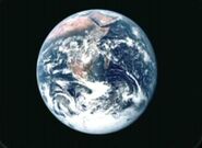
| + | In the late [[20th century]], Africa was seen on the the [[photograph]] "[[The Blue Marble]]". ({{TOS-R|The Cage}}) |
||
During the [[Eugenics Wars]], North Africa was a theater of battle. [[Captain]] [[Jonathan Archer]]'s great-grandfather was involved in a campaign in North Africa. During that conflict, he contacted enemy forces in a successful effort to allow some non-combatant civilians time to get to safety. ({{ENT|Hatchery}}) |
During the [[Eugenics Wars]], North Africa was a theater of battle. [[Captain]] [[Jonathan Archer]]'s great-grandfather was involved in a campaign in North Africa. During that conflict, he contacted enemy forces in a successful effort to allow some non-combatant civilians time to get to safety. ({{ENT|Hatchery}}) |
||
| Line 13: | Line 14: | ||
In the early [[21st century]], Africa was heavily affected by the [[AIDS]] disease. ({{ENT|Future Tense}}) |
In the early [[21st century]], Africa was heavily affected by the [[AIDS]] disease. ({{ENT|Future Tense}}) |
||
| − | In the [[2130s]], Jonathan Archer made a trip to '''East Africa''' where he saw a [[gazelle]] give birth. ({{ENT|Shockwave, Part II}}) |
+ | In the [[2130s]], Jonathan Archer made a trip to '''East Africa''', where he saw a [[gazelle]] give birth. ({{ENT|Shockwave, Part II}}) |
In the early [[23rd century]], [[Nyota Uhura|Uhura]] was born in Africa, and spoke [[Swahili language|Swahili]] as her native language. ({{TOS|Spectre of the Gun}}) |
In the early [[23rd century]], [[Nyota Uhura|Uhura]] was born in Africa, and spoke [[Swahili language|Swahili]] as her native language. ({{TOS|Spectre of the Gun}}) |
||
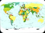
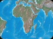
| − | + | Maps of Earth were stored in the {{USS|Enterprise|NCC-1701}}'s [[USS Enterprise (NCC-1701) library computer|library computer]] in [[2254]]. In both the political map and the relief map, Africa was visible. Both maps were among the materials viewed by the [[Talosian]]s when they scanned the ''Enterprise'' computer. ({{TOS-R|The Cage}}) |
|
| ⚫ | |||
| ⚫ | |||
| ⚫ | |||
In [[2335]], [[Geordi La Forge]] was born in the [[African Confederation]]. ({{TNG|Cause and Effect}}) |
In [[2335]], [[Geordi La Forge]] was born in the [[African Confederation]]. ({{TNG|Cause and Effect}}) |
||
| Line 26: | Line 26: | ||
In [[2369]], the [[holodeck]] character of [[Regina Bartholomew]] told [[Reginald Barclay]] of her trip to Africa, where she had taken part in a [[safari]] and was allowed to wear trousers all the time. By this date, Barclay had never been to Africa. ({{TNG|Ship in a Bottle}}) |
In [[2369]], the [[holodeck]] character of [[Regina Bartholomew]] told [[Reginald Barclay]] of her trip to Africa, where she had taken part in a [[safari]] and was allowed to wear trousers all the time. By this date, Barclay had never been to Africa. ({{TNG|Ship in a Bottle}}) |
||
| + | <gallery> |
||
| ⚫ | |||
| + | File:Earth political map.jpg|Africa on a 21st century-era political map of Earth |
||
| ⚫ | |||
| + | File:Earth, The Blue Marble.jpg|Africa on planet Earth |
||
| ⚫ | |||
| + | </gallery> |
||
== Points of interest == |
== Points of interest == |
||
| Line 47: | Line 52: | ||
{{Earth continents}} |
{{Earth continents}} |
||
| − | == Background |
+ | == Background information == |
| ⚫ | According to an ''Original Series'' writer's guide, Uhura was born in [[2239]] in the "[[United States of Africa]]". However, no on-screen evidence for the existence of this political entity has ever been established.|[http://www.imsdb.com/scripts/Star-Trek.html The script] for {{film|11}} explained that at the time of Kirk's corvette incident, his mother was in Africa. |
||
| ⚫ | |||
| + | |||
| + | [[Retroactive continuity]]: Several [[20th century]]-era maps depicting Africa, or portions of it, were stored in the {{USS|Enterprise|NCC-1701}} [[library computer]] in [[2254]]. These maps included a continent projections map, an eastern hemisphere map, a political map of the northern hemisphere, and a statistical map. These maps were among the materials viewed by the [[Talosian]]s when they scanned the ''Enterprise'' computer. ({{TOS|The Cage}}) |
||
| + | |||
| ⚫ | Decades later, a Central Intelligence Agency map was used for the remastered "The Cage". This map was published either in April 2007 [http://www.lib.utexas.edu/maps/world_maps/world_pol_2007.pdf] or September 2008. [http://www.lib.utexas.edu/maps/world_maps/world_pol_2008.pdf] The difference, which was not noticeable at the resolution of the image from the episode, was the addition of Kosovo, which gained its independence between the releases. |
||
<gallery> |
<gallery> |
||
| − | File:Earth |
+ | File:Earth continents.jpg|Africa on a map of Earth's continents |
| − | File: |
+ | File:Eastern hemisphere graphic, The Cage.jpg|Africa on a map of Earth's eastern hemisphere |
| + | File:Earth map, 20th century, Northern Hemisphere.jpg|Africa on a 20th century-era political map of Earth's northern hemisphere |
||
| + | File:Statistical map.jpg|Africa on a statistical map |
||
</gallery> |
</gallery> |
||
| Line 318: | Line 329: | ||
== External link == |
== External link == |
||
* {{wikipedia}} |
* {{wikipedia}} |
||
| + | |||
[[de:Afrika]] |
[[de:Afrika]] |
||
[[fr:Afrique]] |
[[fr:Afrique]] |
||
Revision as of 21:51, 25 November 2015
AT: "xx" Africa was a continent on Earth. It had coastlines on the North and South Atlantic Oceans, the Mediterranean, and the Indian Ocean. The equator, a line of latitude which divided the Earth into northern and southern hemispheres, ran through the continent. Northern Africa was where some of the Middle Eastern countries were located.
During World War II, German general Erwin Rommel fought in North Africa, as did the character played by the Hirogen Karr in a holoprogram. (VOY: "The Killing Game")
In an alternate timeline, the Nazi and Na'kuhl alliance faced several setbacks in World War II action in Africa during 1944. (ENT: "Storm Front")
In the 1960s, the mission insignia for Apollo 8 and Apollo 11 included western Africa in its design. (ENT: "First Flight")
In the late 20th century, Africa was seen on the the photograph "The Blue Marble". (TOS-R: "The Cage")
During the Eugenics Wars, North Africa was a theater of battle. Captain Jonathan Archer's great-grandfather was involved in a campaign in North Africa. During that conflict, he contacted enemy forces in a successful effort to allow some non-combatant civilians time to get to safety. (ENT: "Hatchery")
In the early 21st century, Africa was heavily affected by the AIDS disease. (ENT: "Future Tense")
In the 2130s, Jonathan Archer made a trip to East Africa, where he saw a gazelle give birth. (ENT: "Shockwave, Part II")
In the early 23rd century, Uhura was born in Africa, and spoke Swahili as her native language. (TOS: "Spectre of the Gun")
Maps of Earth were stored in the USS Enterprise's library computer in 2254. In both the political map and the relief map, Africa was visible. Both maps were among the materials viewed by the Talosians when they scanned the Enterprise computer. (TOS-R: "The Cage")
An identical landmass to Africa was observed on Miri's homeworld in 2267, which was an exact replica of the planet Earth. (TOS: "Miri")
In 2335, Geordi La Forge was born in the African Confederation. (TNG: "Cause and Effect")
In 2369, the holodeck character of Regina Bartholomew told Reginald Barclay of her trip to Africa, where she had taken part in a safari and was allowed to wear trousers all the time. By this date, Barclay had never been to Africa. (TNG: "Ship in a Bottle")
Points of interest
See also
| Continents of Earth |
|---|
| Africa • Antarctica • Asia • Australia • Europe • North America • South America |
Background information
According to an Original Series writer's guide, Uhura was born in 2239 in the "United States of Africa". However, no on-screen evidence for the existence of this political entity has ever been established.|The script for Star Trek explained that at the time of Kirk's corvette incident, his mother was in Africa.
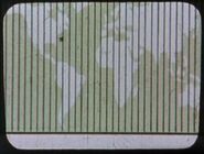
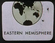
Retroactive continuity: Several 20th century-era maps depicting Africa, or portions of it, were stored in the USS Enterprise library computer in 2254. These maps included a continent projections map, an eastern hemisphere map, a political map of the northern hemisphere, and a statistical map. These maps were among the materials viewed by the Talosians when they scanned the Enterprise computer. (TOS: "The Cage")
Decades later, a Central Intelligence Agency map was used for the remastered "The Cage". This map was published either in April 2007 [1] or September 2008. [2] The difference, which was not noticeable at the resolution of the image from the episode, was the addition of Kosovo, which gained its independence between the releases.
| Features from the CIA map | ||
|---|---|---|
| Country | Capital | Notes |
| Algeria | Algiers | A northern African country. Major cities - Constantine, Oran. |
| Angola | Luanda | A central African country. Major city - Namibe. |
| Bassas da India | A Mozambique Channel territory of France. | |
| Benin | Porto Novo | A western African country. |
| Botswana | Gaborone | A southern African country. |
| Burkina Faso | Ouagadougou | A western African country. |
| Burundi | Bujumbura | An eastern African country. |
| Cameroon | Yaounde | A central African country. Major city - Douala. |
| Canary Islands | A North Atlantic Ocean territory of Spain. | |
| Cape Verde | Praia | A western African country. |
| Central African Republic | Bangui | A central African country. |
| Ceuta | An exclave of Spain in Morocco. | |
| Chad | N'Djamena | A central African country. |
| Comoros | Moroni | An eastern African country. |
| Cote d'Ivoire | Yamoussoukro | A western African country. Major city - Abidan. |
| Democratic Republic of the Congo | Kinshasa | A central African country. Major cities - Lubumbashi, Kisangani, Mbuji-Mayi. |
| Djibouti | Djibouti | An eastern African country. |
| Egypt | Cairo | A northern African country. Major cities - Alexandria, Al Jizah, Aswan. |
| Equatorial Guinea | Malabo | A central African country. |
| Eritrea | Asmara | An eastern African country. |
| Ethiopia | Addis Ababa | An eastern African country. |
| Europa Island | A Mozambique Channel territory of France. | |
| Gabon | Libreville | A central African country. |
| Gambia | Banjul | A western African country. |
| Ghana | Accra | A western African country. |
| Glorioso Islands | A Mozambique Channel territory of France. | |
| Guinea | Conakry | A western African country. |
| Guinea-Bassau | Bissau | A western African country. |
| Juan de Nova Island | A Mozambique Channel territory of France. | |
| Kenya | Nairobi | An eastern African country. Major city - Mombasa. |
| Lesotho | Maseru | A southern African country. |
| Liberia | Monrovia | A western African country. |
| Libya | Tripoli | A northern African country. Major city - Benghazi. |
| Madagascar | Antananarivo | An eastern African country. |
| Malawi | Lilongwe | An eastern African country. Major city - Blantyre. |
| Mali | Bamako | A western African country. Major city - Tombouctou. |
| Mauritania | Nouakchott | A western African country. |
| Mauritius | Port Louis | An eastern African country. |
| Mayotte | An Indian Ocean island "administered by France, claimed by Comoros" | |
| Melila | An exclave of Spain in Morocco. | |
| Morocco | Rabat | A northern African country. Major cities - Casablanca, Fès, Marrakech. |
| Mozambique | Maputo | An eastern African country. Major city - Beira. |
| Namibia | Windhoek | A southern African country. Major city - Walvis Bay. |
| Niger | Niamey | A western African country. |
| Nigeria | Abuja | A western African country. Major cities - Ibadan, Kano, Lagos, Ogbomoso. |
| Republic of the Congo | Brazzaville | A central African country. Major city - Pointe-Noire. |
| Réunion | Saint-Denis | An Indian Ocean territory of France. |
| Rwanda | Kigali | An eastern African country. |
| Saint Helena | A South Atlantic Ocean territory of the United Kingdom. Islands in this territory - Ascension Island, Gough Island, Saint Helena, Tristan de Cunha. | |
| São Tomé and Príncipe | São Tomé | A central African country. |
| Senegal | Dakar | A western African country. |
| Seychelles | Victoria | An eastern African country. |
| Sierra Leone | Freetown | A western African country. |
| Somalia | Mogadishu | A eastern African country. Major city - Hargeysa. |
| South Africa | Pretoria | A southern African country. Major cities - Cape Town, Durban, Johannesburg, Port Elizabeth. |
| Sudan | Khartoum | A northern African country. Major cities - Iuba, Kassala, Nyala, Omdurman, Port Sudan, Omdurman. |
| Tanzania | Dar es Salaam | An eastern African country. Major city - Dodoma. |
| Togo | Lomé | A western African country. |
| Tromelin Island | An Indian Ocean territory of France. | |
| Tunisia | Tunis | A northern African country. |
| Uganda | Kampala | An eastern African country. |
| Zambia | Lusaka | An eastern African country. Major city - Ndola. |
| Zimbabwe | Harare | An eastern African country. |
